Scan2Plan Landscape
We've spent the past 5 years mastering the documentation of the built world. We’ve scanned over 1,000 buildings (~10M sqft), helping firms to focus on design. This year we are developing procedures and standards for a new frontier - the natural world.

Introducing Scan2Plan Landscape, advanced topographic design documents in BIM or CAD. We’re making it simple with easy pricing and standards. Site plans are available at 1’ or 5’ contours, geolocation & forestry are new options. We are actively seeking new partners in Licensed Surveyors, Landscape Architects and Designers. If you know anyone who may fit, please reach out!
Here are a few of the complex landscape projects we’ve developed this year:
Deep Forest Property

This 9 acre project was mapped with terrestrial LiDAR in a densely forested area including some treacherous ravines. The topography would’ve been impossible with a drone and far less accurate with traditional survey equipment. The site plan includes our forestry service where we identified each significant tree and it’s approximate diameter.
““We’ve partnered with Scan2Plan on many houses over the years. Now these landscape capabilities open up a new world of possibilities for design we can offer” ”

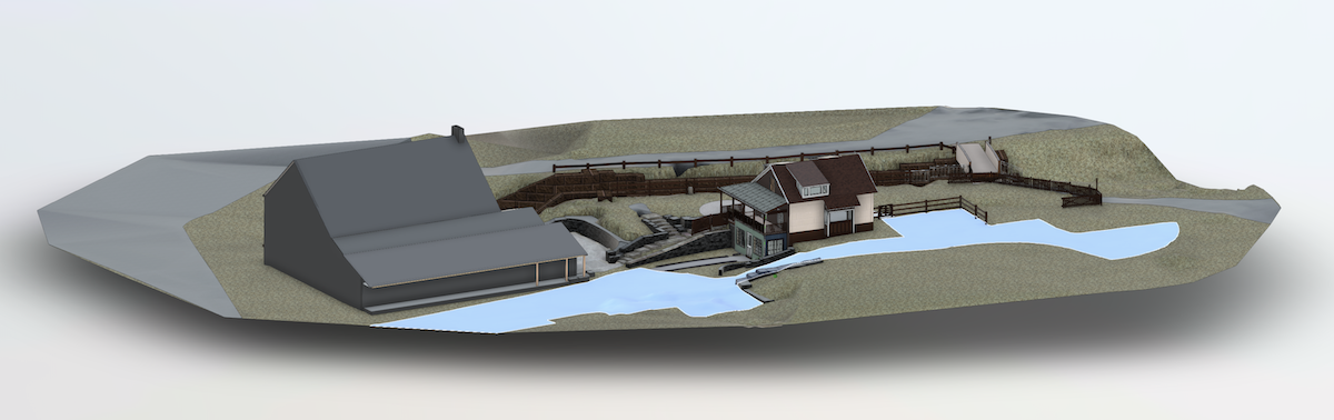
Farm Estate

This 6 acre project Included a detailed model of the residence as well as massing models of 7 other structures on the property. A site plan was delivered at 1’ contours.

“We’re confident to have Scan2Plan’s point cloud dataset as a single point of truth to coordinate this project moving forward.”
D&H Canal Museum
The D&H Canal Museuml is on the national historic register. We mapped the historic courtyard area including a lock along the Delaware and Hudson Canal in Ulster County and a jumble of stairs.
“It’s fantastic to receive a model of this complicated historic landscape architecture, Scan2Plan delivers, again!”